North Lincolnshire
North Lincolnshire is a unitary authority area with borough status in Lincolnshire, England. At the 2011 Census, it had a population of 167,446.[2] The administrative centre and largest settlement is Scunthorpe, and the borough also includes the towns of Brigg, Broughton, Haxey, Crowle, Epworth, Bottesford, Winterton, Kirton in Lindsey and Barton-upon-Humber. North Lincolnshire is part of the Yorkshire and the Humber region. The borough is mostly rural in character aside from near the town of Scunthorpe and near the Port of Immingham where most of the nearby villages and towns form part of the wider urban areas.
North Lincolnshire was formed following the abolition of Humberside County Council in 1996, when four unitary authorities replaced it, North Lincolnshire and North East Lincolnshire, on the south bank of the Humber Estuary, and the East Riding of Yorkshire and Kingston upon Hull on the north bank.

It is home to the Haxey Hood, a traditional event which takes place in Haxey on 6 January, a large football scrum where a leather tube (the "hood") is pushed to one of four pubs, where it remains until next year's game.
Location
[edit]
The 846 km2 (327 sq mi) council area lies on the south side of the Humber Estuary and consists mainly of agricultural land, including land on either side of the River Trent. It borders onto North East Lincolnshire, Lincolnshire, South Yorkshire, Nottinghamshire and the East Riding of Yorkshire. The council is based in Scunthorpe.

History of area
[edit]
The former districts of Glanford, Scunthorpe, and the southern part of Boothferry, were non-metropolitan districts of the county of Humberside from 1974 to 1996. Humberside was abolished that year and those three districts merged to form the new unitary authority area of North Lincolnshire, as part of an expanded Lincolnshire ceremonial county. The area had previously been within the Lincolnshire administrative county before 1974 as a collection of municipal boroughs, urban districts, and rural districts. The new district of North Lincolnshire was awarded borough status on 16 December 1996, allowing the chair of the council to take the title of mayor.[3]
Towns and villages
[edit]- Alkborough, Althorpe, Amcotts, Appleby, Ashby
- Barrow Haven, Barrow upon Humber, Barnetby le Wold, Barton on Humber, Belton, Beltoft, Bonby, Bottesford, Brigg, Broughton, Burringham, Burton upon Stather
- Cadney, Coleby, Crowle, Croxton
- Dragonby
- Ealand, East Butterwick, East Halton, Eastoft, Elsham, Epworth, Epworth Turbary
- Flixborough, Fockerby, Ferriby Sluice
- Gainsthorpe, Garthorpe, Goxhill, Grasby, Gunness
- Haxey, Hibaldstow, Horkstow, Howsham
- Keadby, Keelby, Kingsforth, Kirmington, Kirton in Lindsey
- Luddington
- Manton, Melton Ross, Messingham, Mill Place
- New Holland, North Killingholme
- Owston Ferry
- Redbourne, Roxby
- Sandtoft, Santon, Saxby All Saints, Scawby with Sturton, Scunthorpe, South End, South Killingholme, South Ferriby
- Thornton Curtis
- Ulceby, Ulceby Skitter
- Walcot, Westwoodside, West Butterwick, West Halton, Whitton, Winteringham, Winterton, Wootton, Worlaby, Wrawby, Wressle
- Yaddlethorpe
Politics
[edit]The local authority is North Lincolnshire Council, based in at Church Square House in the centre of Scunthorpe.
The area is represented in parliament by three MPs. At the 2010 election the Labour Party retained the Scunthorpe seat and the Conservative Party won the Brigg and Goole seat and the Cleethorpes seat which includes the Barton area.
Economy
[edit]This is a chart of trend of regional gross value added of North and North East Lincolnshire at current basic prices published (pp. 240–253) by Office for National Statistics with figures in millions of British Pounds Sterling. 2004 onwards published (pp. 139) in 2007 [needs update]
| Year | Regional Gross Value Added[4] |
Agriculture[5] | Industry[6] | Services[7] |
|---|---|---|---|---|
| 1995 | 3,512 | 82 | 1,701 | 1,729 |
| 2000 | 3,861 | 60 | 1,805 | 1,997 |
| 2003 | 4,569 | 62 | 1,896 | 2,611 |
| 2004 | 4,838 | – | – | – |
| 2005 | 4,941 | – | – | – |
| 2006 | 5,126 | – | – | – |
| 2007 | 5,494 | – | – | – |
Eastern Airways has its head office in the Schiphol House on the grounds of Humberside Airport in Kirmington, North Lincolnshire.[8] Scunthorpe is the home of the British Steel owned Appleby-Frodingham steel plant, one of the largest and most successful plants in Europe. Port operations, green energy, logistics, agriculture and food processing are important elements of the areas employment profile.
Media
[edit]In terms of television, the area is covered by BBC Yorkshire and Lincolnshire which broadcast from Hull and ITV Yorkshire broadcasts from Leeds. Television signals are received from the Belmont TV transmitter.[9]
Radio stations for the area are BBC Radio Humberside, Hits Radio East Yorkshire & North Lincolnshire, Nation Radio East Yorkshire, and Greatest Hits Radio East Yorkshire & Northern Lincolnshire. Community based stations are Steel FM (for Scunthorpe)[10] and TMCR 95.3 (covering Epworth and Isle of Axholme).
Education
[edit]Gallery
[edit]-
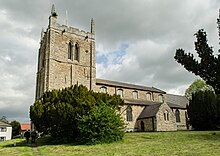
St. Hybald Church in Hibaldstow, Brigg
-
Scunthorpe Steelworks in Scunthorpe
-
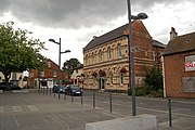
Crowle town centre
References
[edit]- ^ a b UK Census (2021). "2021 Census Area Profile – North Lincolnshire Local Authority (E06000013)". Nomis. Office for National Statistics. Retrieved 5 January 2024.
- ^ UK Census (2011). "Local Area Report – North Lincolnshire Local Authority (1946157111)". Nomis. Office for National Statistics. Retrieved 2 March 2018.
- ^ Bulletin of Changes of Local Authority Status, Names and Areas 1 April 1994 – 31 March 1997 (PDF). London: Department of the Environment. 1997. Retrieved 3 July 2023.
- ^ Components may not sum to totals due to rounding
- ^ includes hunting and forestry
- ^ includes energy and construction
- ^ includes financial intermediation services indirectly measured
- ^ "Contact Us]". Eastern Airways. Archived from the original on 16 December 2009. Retrieved 2 May 2010.
- ^ "Belmont (Lincolnshire, England) Full Freeview transmitter". UK Free TV. 1 May 2004. Retrieved 8 April 2024.
- ^ "Steel FM". Retrieved 24 October 2023.


